Slope Raster
The Slope Raster tool generates a new raster in the survey geodatabase that captures the slope of the digital elevation model (DEM). This tool simply runs the ArcGIS Slope geoprocessing tool and stores the resultant raster in the survey geodatabase.
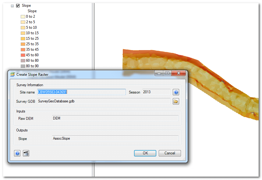
Double click the the Slope Raster Tool in the Workflow Manager and then click OK. You will be prompted to overwrite if a slope raster already exists in the survey geodatabase.